While the Caribbean Island of St. Maarten is already an attraction of its own, it is also surrounded by a couple of other beautiful islands that I couldn't resist but visit.
St. Barths
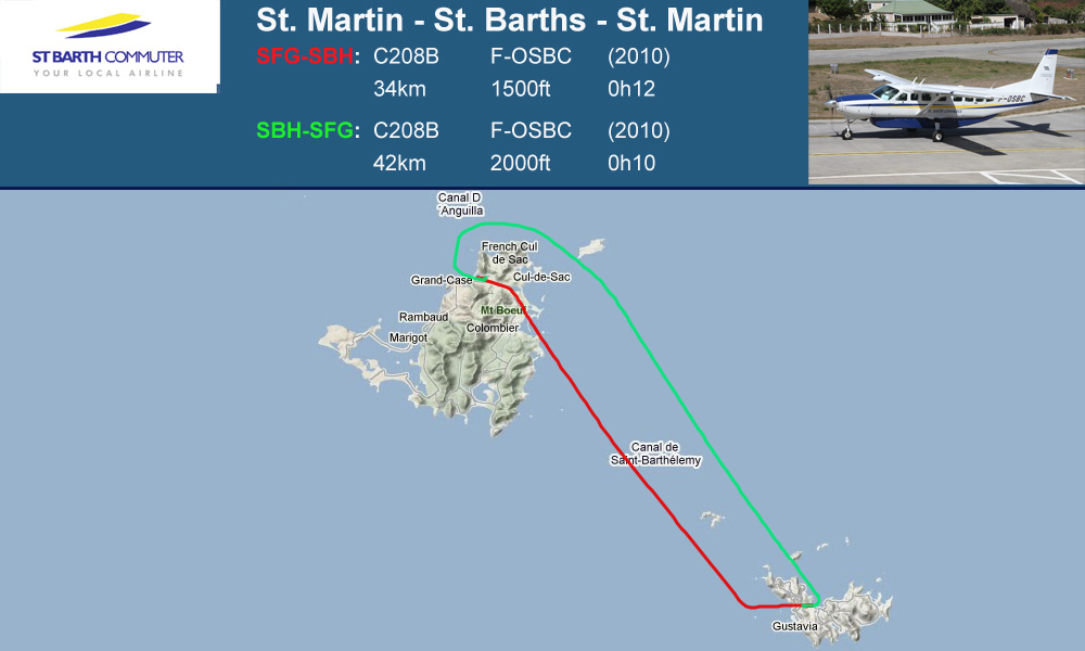
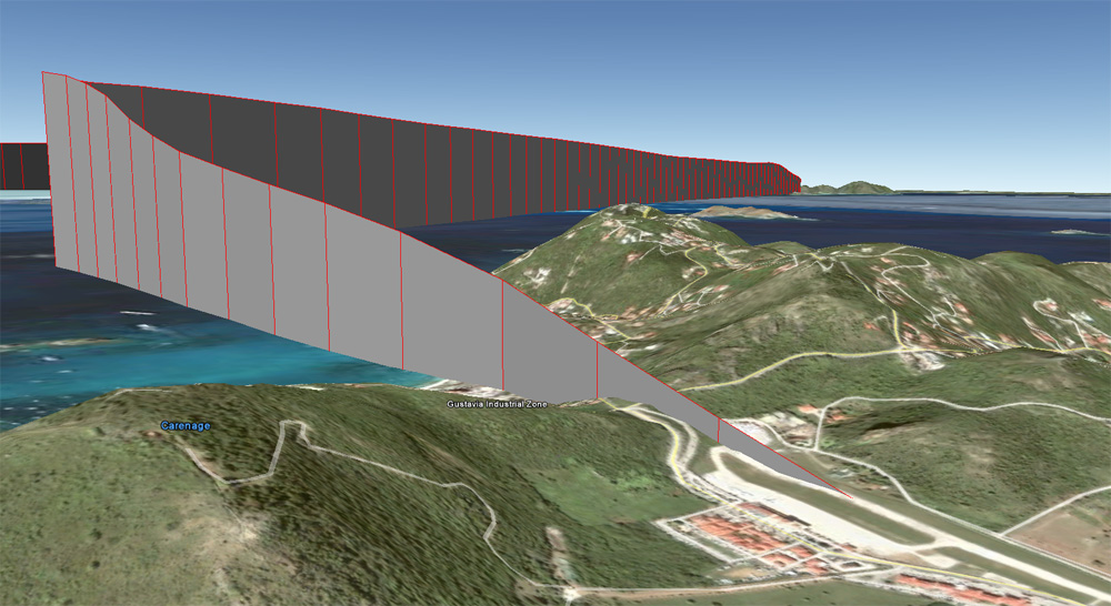
GPS Track: [url]http://de.wikiloc.com/wikiloc/view.do?id=1691525[/url]
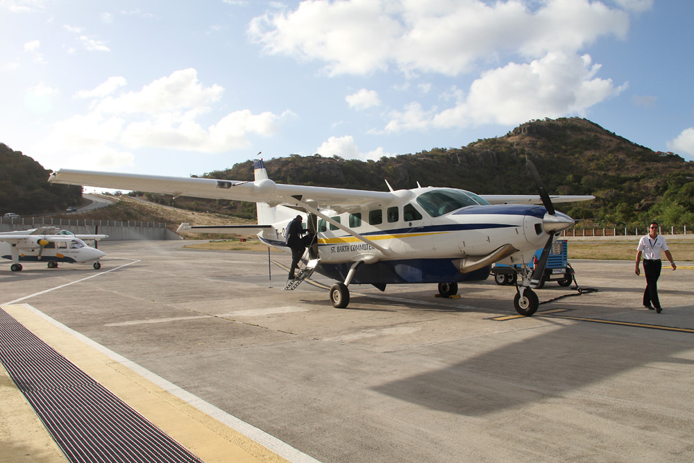
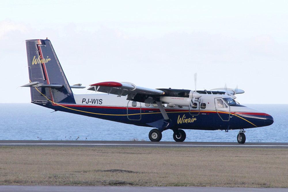
As you may have noticed on the map above, the tracks don't originate from St. Maarten's famous Juliana Airport, but from its north. That's correct! The french side has its own airport named Grand Case - however, an occasional ATR is the biggest movement you gonna get there. It also the base for a regional airline called St. Barths Commuter, which, as its name reveals, predominately shuttles back and forth between St. Maarten and St. Barths, mostly using Britten Norman Islanders. Since I still hadn't had the pleasure to fly on an Islander back then, this was the obvious choice for me.
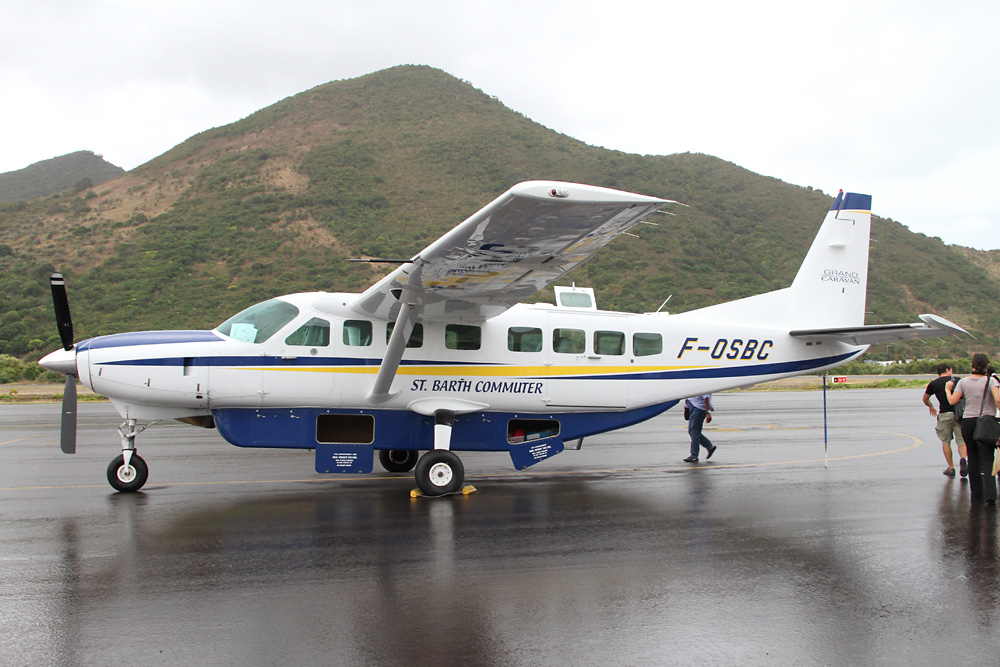
Unfortunately, the daytrip started out bad in two ways: First, low clouds and rain aren't really what you expect from this part of the world. And secondly, my Islander had been replaced by a brand new Cessna Grand Caravan. Zut alors!
Something other caught me by surprise: Grand Case - St. Barths counts as a flight within the EU - therefore our suncream for the day (read: liquid) was considered evil, and had to stay behind. Haha.
Well, well - no sun to be seen anyway. Looking down on a village called Oyster Pond after departure

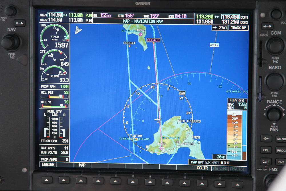
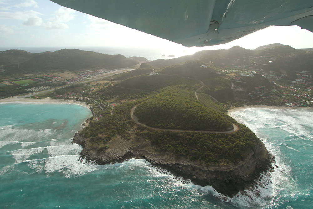
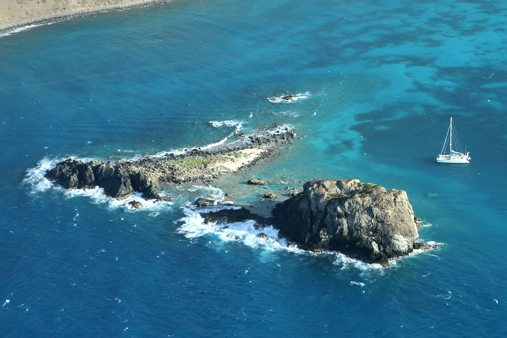
With regard to the high traffic between the two islands, a VFR Corridor has been set up, assuring that everyone follows the same rules. This is wonderfully displayed on the huge screens of our Cessna - we're already heading for a reporting point called "Sugarloaf", located overhead a small rocky island in the approach path to St. Barths.
Over the sugarloaf already, looking towards the airport

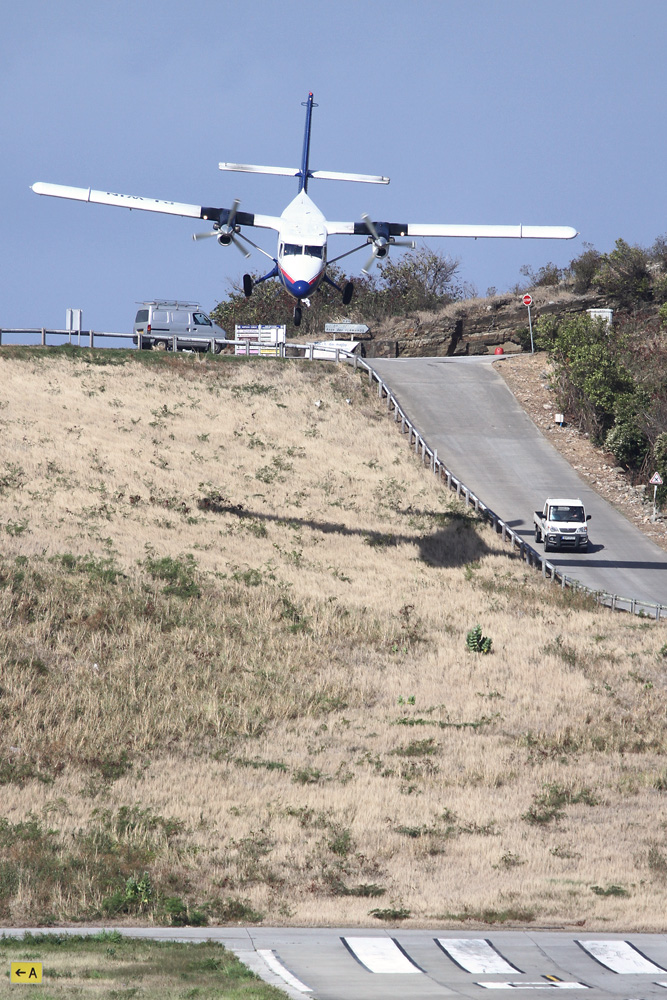
I'm sure you all know about the special approach to Rwy 10: There's that stupid hill in the approach path, only a few meters from the touchdown zone - requiring a real dive down to the runway. Yeeeha!
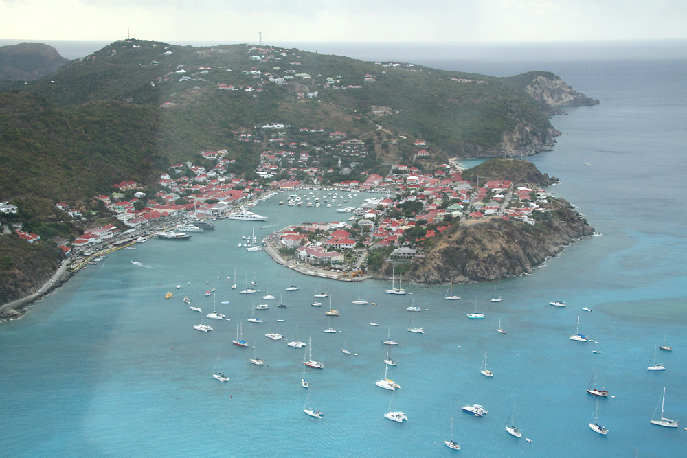
A short glance out the right window reveals the island's capital, Gustavia, and dozens of parked yachts
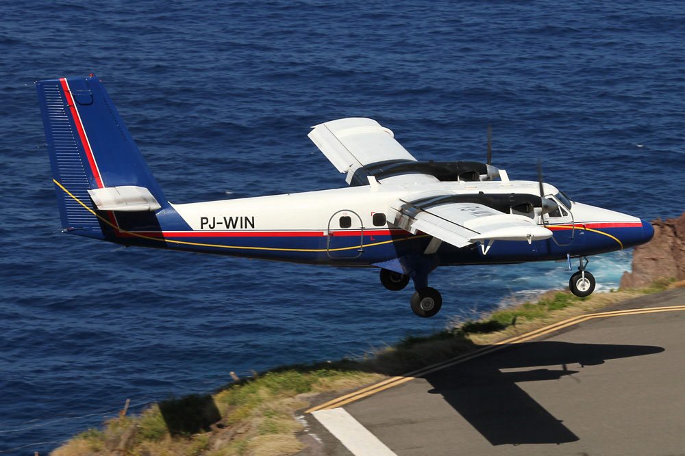
Better look out straight ahead again! Our single french pilot takes aim at the runway, pushes the nose down, and after flaring until almost the middle of the ruwnay, finally touches down.

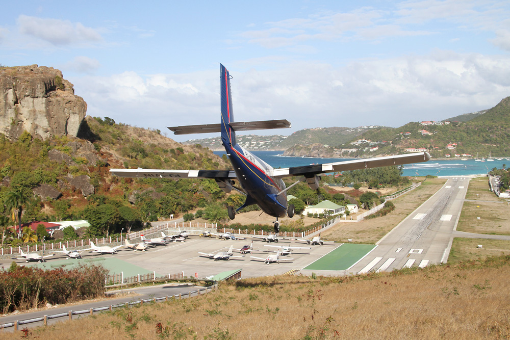
A few minutes later I've already set up camp at the beautiful beach at the end of the runway. Looking very impressive!
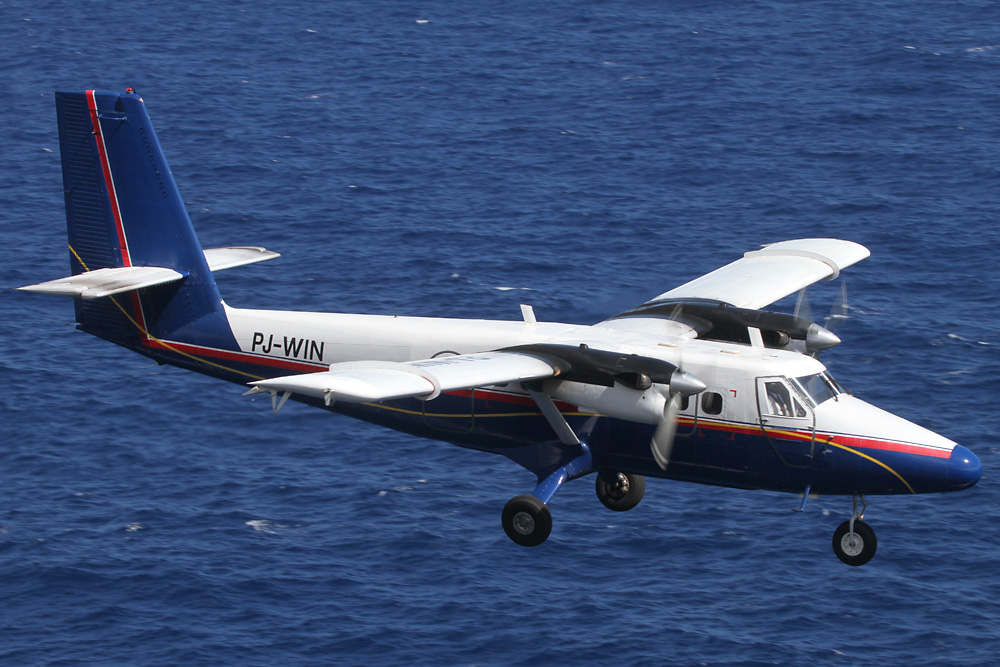
In the afternoon, the light is good on the other side of the airport, and so I also got the typical St. Barths shots I had wished for
When it was time for my flight back, I saw an Islander getting readied out on the tarmac and had high hopes I could finally tick this type off my to-do list. Wrong again, just then their Caravan came rushing down the hill to pick us up again. Oh well...
At least the weather was a lot better this time, and allowed me a nice view of th Baie de Saint Jean right behind the airport

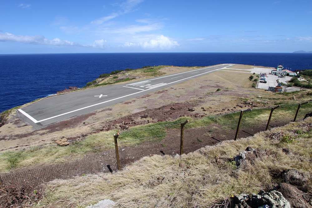
A last overview of the tiny airport and its beautiful setting
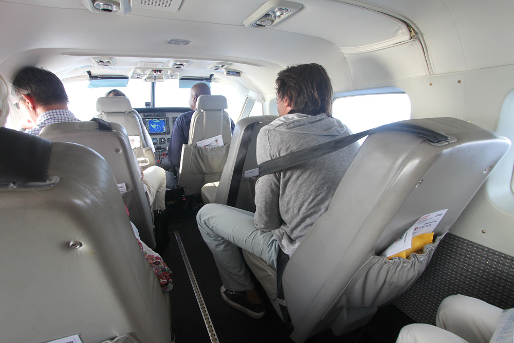
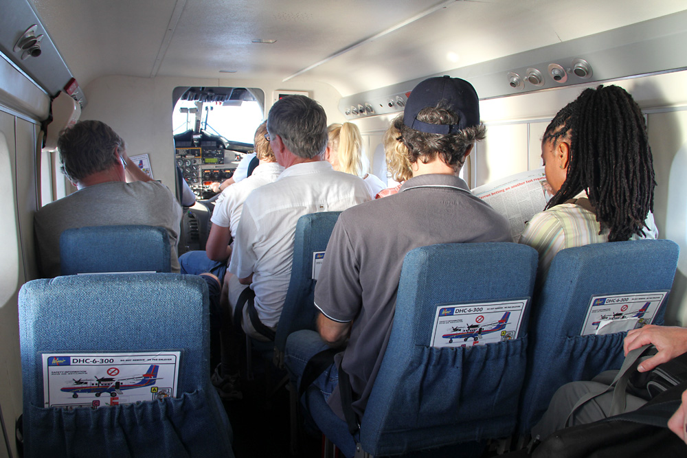
To everyone else, the upgrade from the old Islander to the brand new Caravan was a great improvement: The Cabin felt roomy, comfy and luxurious with those leather seats, while it would have been a much more cramped experience in the Islander.
Already on left-hand downwind for Grand Case, we pass this beautiful islet
On finals, over the roofs of Grand Case

All things considered: St. Barth is a great choice for a daytrip. Flights are short, the approach is fascinating, and planespotters can get some great shots regardless of the runway direction in use - while the rest of the family can enjoy the stunning beach, just a 10 minutes' walk from the terminal.
After a break of one day, I was ready for the next island adventure!
Saba
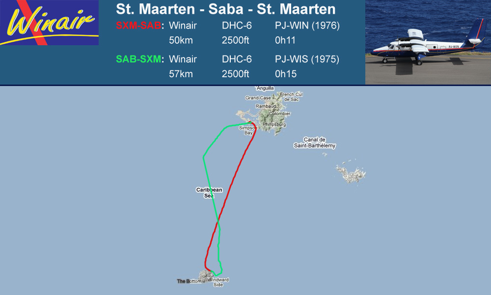
GPS Track: [url]http://de.wikiloc.com/wikiloc/view.do?id=1691527[/url]
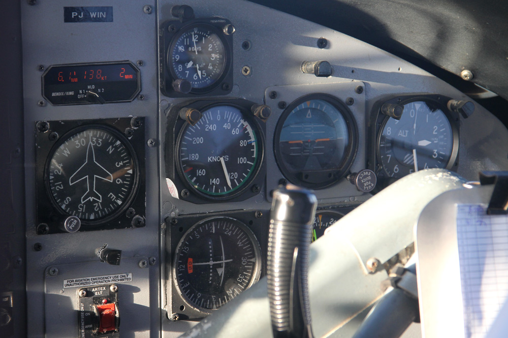
A little after 6 in the morning I checked in, and about an hour later the flight was finally called: It’s Twin Otter time!

After having to wait for three minutes at the runway until the airport officially opened at 7 o'clock, we were finally ready to get going. After a third of the runway we were airborne and immediately turned right in the direction of Saba, the small volcanic island that can already be identified at the horizon from St. Maarten.

Relaxed cruise on 2'500ft...
...while Saba's distinctive silhouette is getting closer and closer!
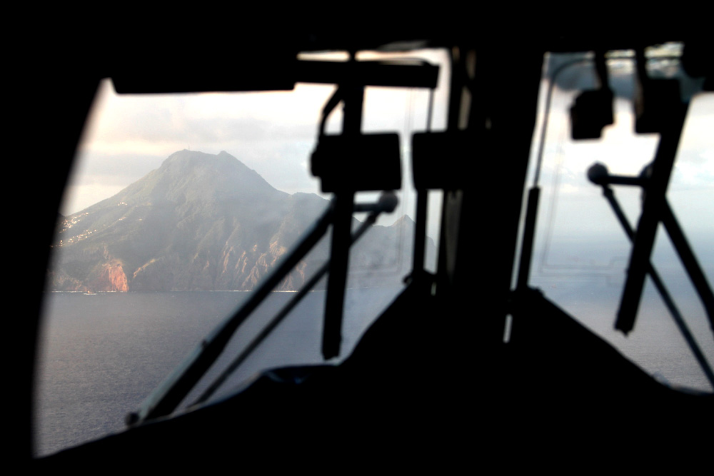
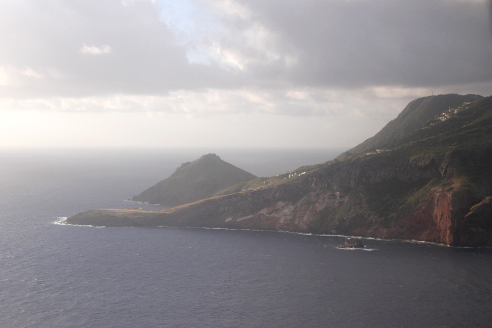
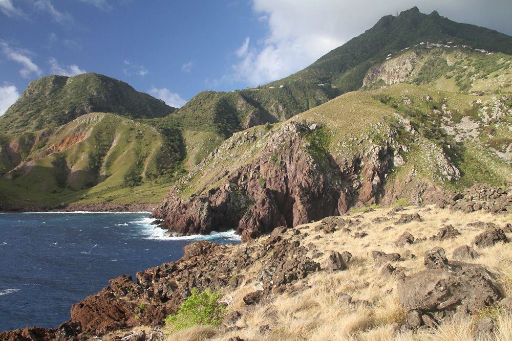
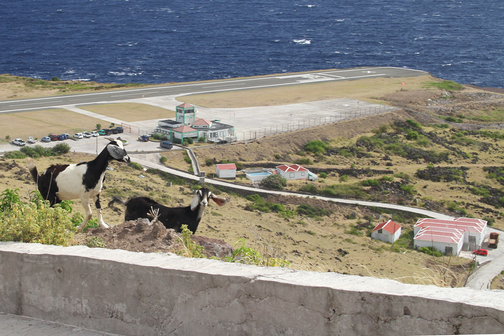
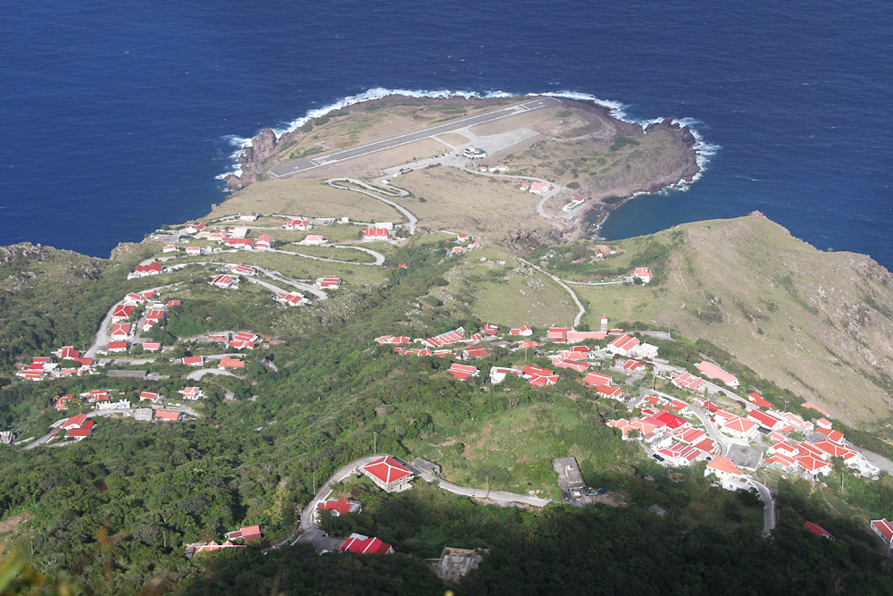
The island's steep and rugged terrain doesn't leave much space for a runway - and so people had to use what was there in terms of flat land: A very limited area called "flat point", only measuring a mere 400 meters at its widest point. This led to Saba having the shortest commercially operated runway of the world at 396 meters or 1'300 ft. The approach isn't a walk in the park either: You are flying pretty close to some steep cliffs on the right, and the wind's usually a bit tricky, too.
Here's how it looks in reality: "Flat Point" is already in sight!
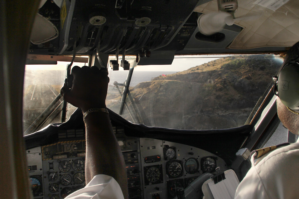
The Prop RPM is brought back to Max, and with the huge prop blades now acting like spoilers, they quickly slow our aircraft down to the approach speed of about 60 knots

Every knot counts on this short runway, so thanks to a steady headwind we end up approaching with a groundspeed of only 45 knots - makes every little Cessna jealous I bit; even more considering the Otter transports up to five times as many passengers. What an engineering marvel this plane is!
Screetch - wuuuuuuuuuuuuuuuuuuuuuuhm - aaaah. In the time it took you to read this, we touched down and came to a standstill - after half of the runway! That's 200 meters! As you can see, I am really impressed! And this without any reverse at all!
If you like watching a vid, here's one - not by me though. It gets interesting from 1:30 onwards.
[url]http://www.youtube.com/watch?v=pL6arxGugKM[/url]
Welcome to Saba!
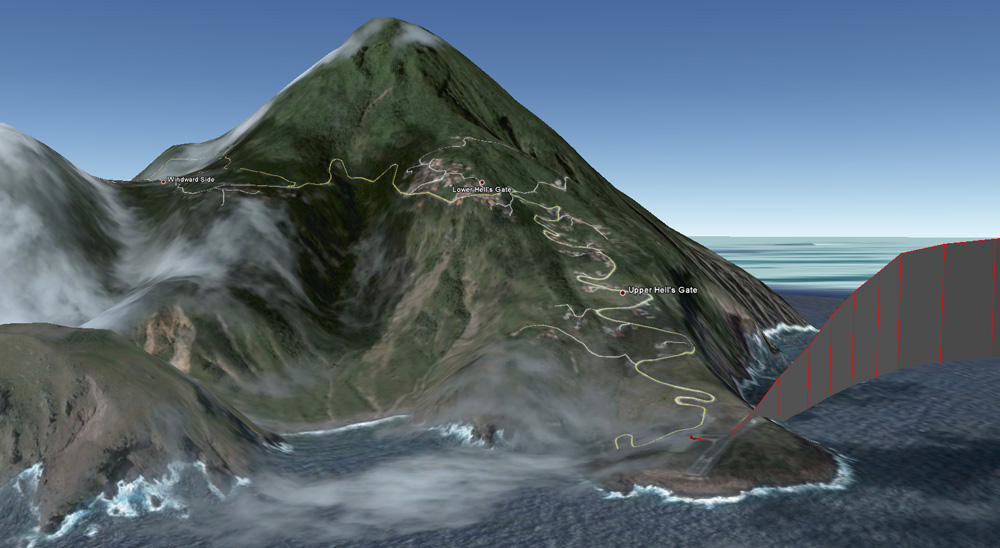
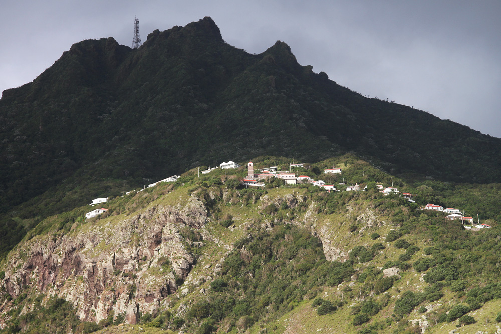
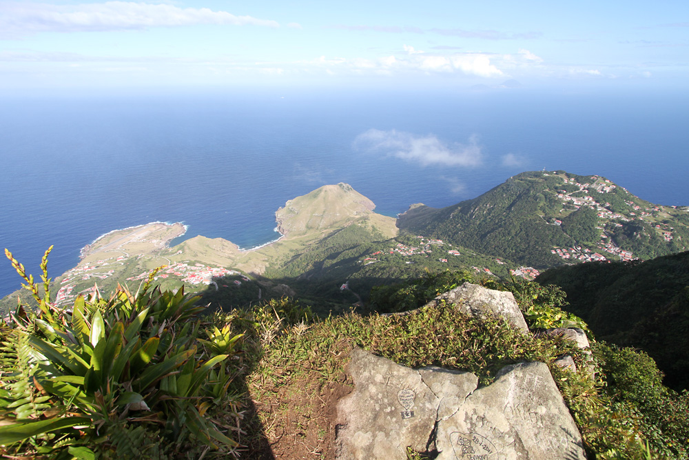
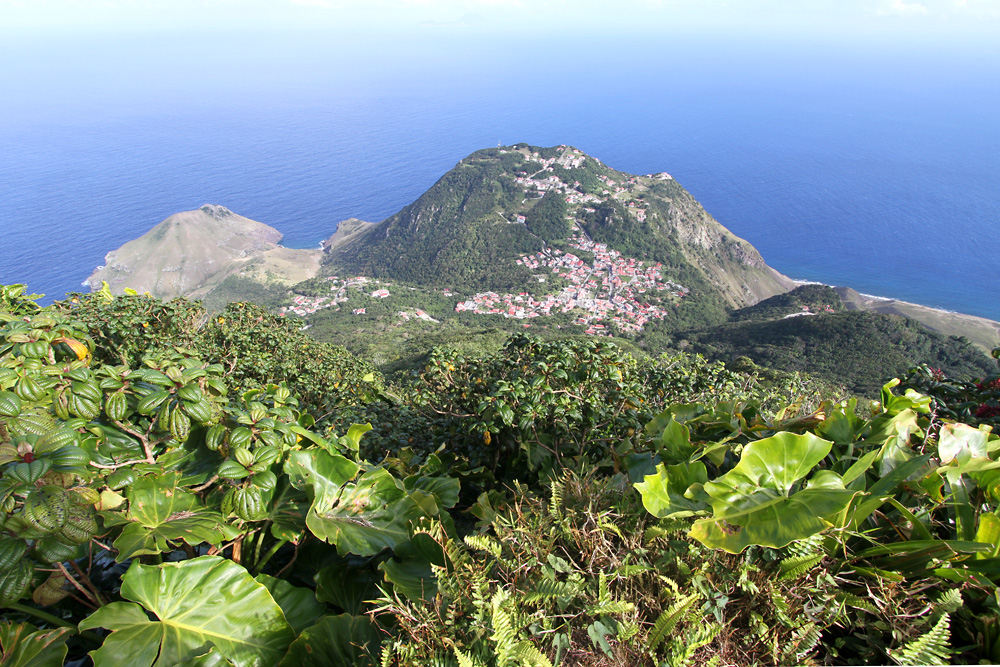
Not only Saba's airport is a highlight, but also the small island, measuring a mere 13 square kilometers. While waiting for the next plane to approach 3 hours later, I had a little look at the area around the airport. On the right, up in the clouds, my ultimate goal is lying: Mount Scenery, the highest mountain in the kingdom of the Netherlands.
Halfway up lies the very aptly named village Hell's Gate.
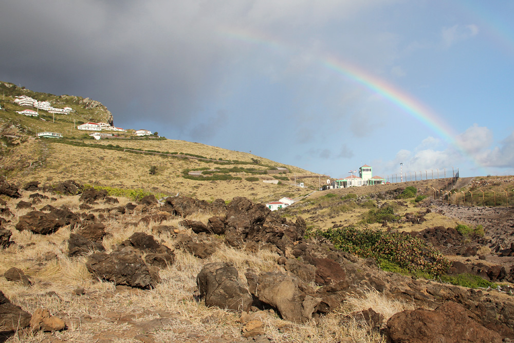
The airport is surrounded by lava fields, and only served by this small and winding road
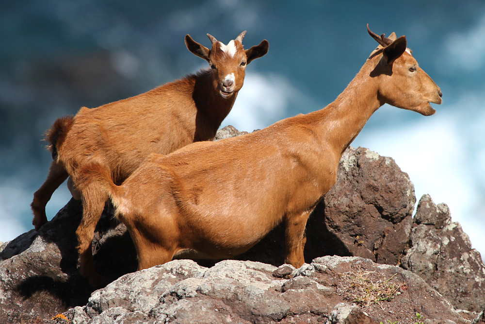
Yeah, this one!

Well, I've made friends with means creatures while planespotting - but mountain goats definitely were a first!
30 minutes before the arrival of the next plane, I climbed to a spot to watch it land - of course, even the spotting points lead to great views on this island!
Finally, the second out of four movements of the day!
Barely clearing the cliffs...
The right engine remains running during the whole boarding process, and so, after only seven minutes, the Twin Otter is ready to go again!

Here's a little airport overview of this one-of-a-kind airport!
With those pics shot, I had done enough spotting and was ready to discover the rest of the island. I called a taxi to carry me all the way uphill to the village of Windwardside, where I had reservated a room in the small but lovely hotel named Scout's Lookout - on a five week trip through the Caribbean, this wasn't only the cheapest place, but also the one with the most welcoming staff. Great!!
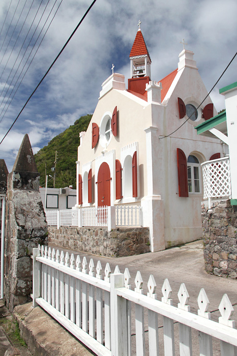
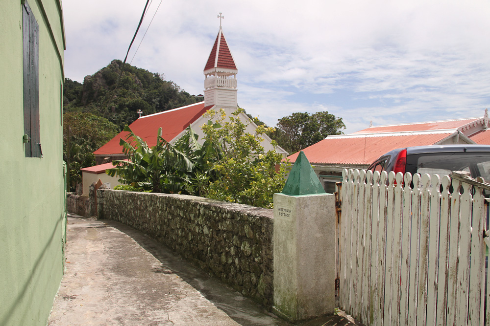
Another church ;)
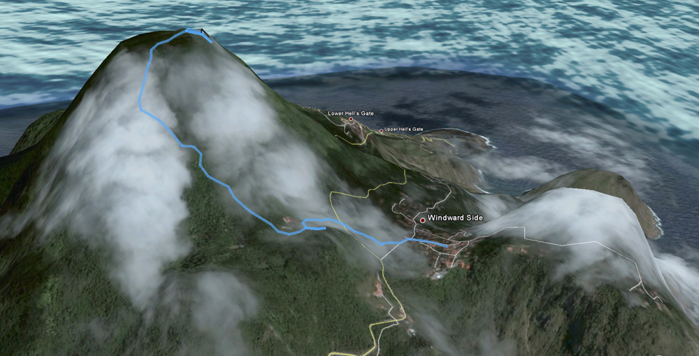
There was no time to relax yet, though, since I had to squeeze in my next adventure: Hiking to the Netherlands' highest point, Mount Scenery, a possibly still active volcano, reaching up to 877 meters above sea level. 1064 steps to go up...
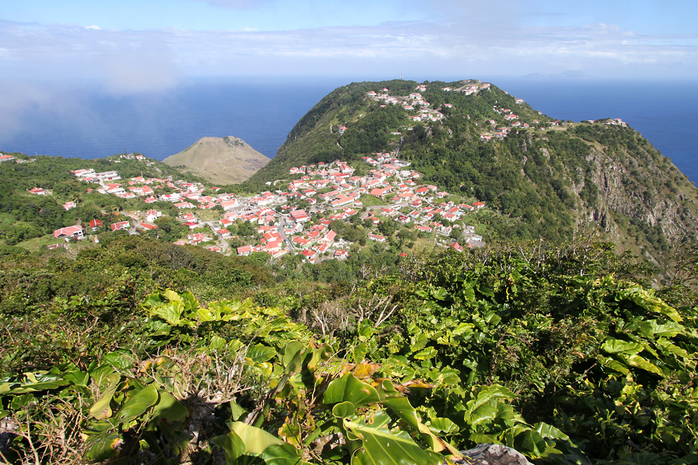
After a few hundred of them, I got the first great view of my village of Windwardside
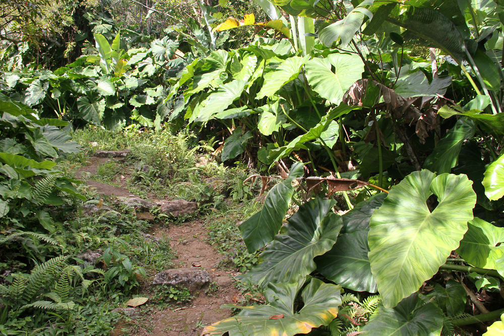
No time for a break yet! It's hot and humid, and the path leads through a dense rain forest. Nice!

A little piece of paradise! Not only the flora was amazing, but also all the colourful insects that were buzzing all around my head - like this flock of butterflies.

In the higher altitudes, those giant leaves were framing the way
Thanks to its isolated location high up on a small island, Mount Scenery's top is usually covered in clouds. Feeling that I had only minutes left till the clouds returned, I hurried even more, and reached the top after a mere 35 minutes (instead of the 90 all hiking maps were telling me I would need).
Great timing, since I had a minute or two to enjoy the stunning views...
...bevore the clouds started moving in again and took away the views in a matter of seconds.

I did have food and reading material galore, and so I waited two hours on top, hoping the clouds would clear again. They didn't for long, but a gap here and there allowed me a view down on my village of Windwardside...
...or down to Hell's Gate and the airport
The whole time, I didn't meet a single other soul up there. And so, the descent through the misty rainforest was feeling extremely special and beautiful - alone with this almost magical piece of nature. Finally, I heard loud shouting and chanting from far below. My visit had coincided with the election of the island's new president, and obviously they had finally found a winner...
This was it with a peaceful evening on this laid-back island - and since the winner's party was held in my hotel, there wasn't much sleep in the night either!
Thankfully, heavy rain showers the next morning gave me the perfect excuse to sleep in. When they finally cleared, I started the 5km walk down to the airport. An easy walk along the road, and no problem - except for a angry sounding dog barking at you from every house. Yet, some nice views are there as a reward

More wildlife!
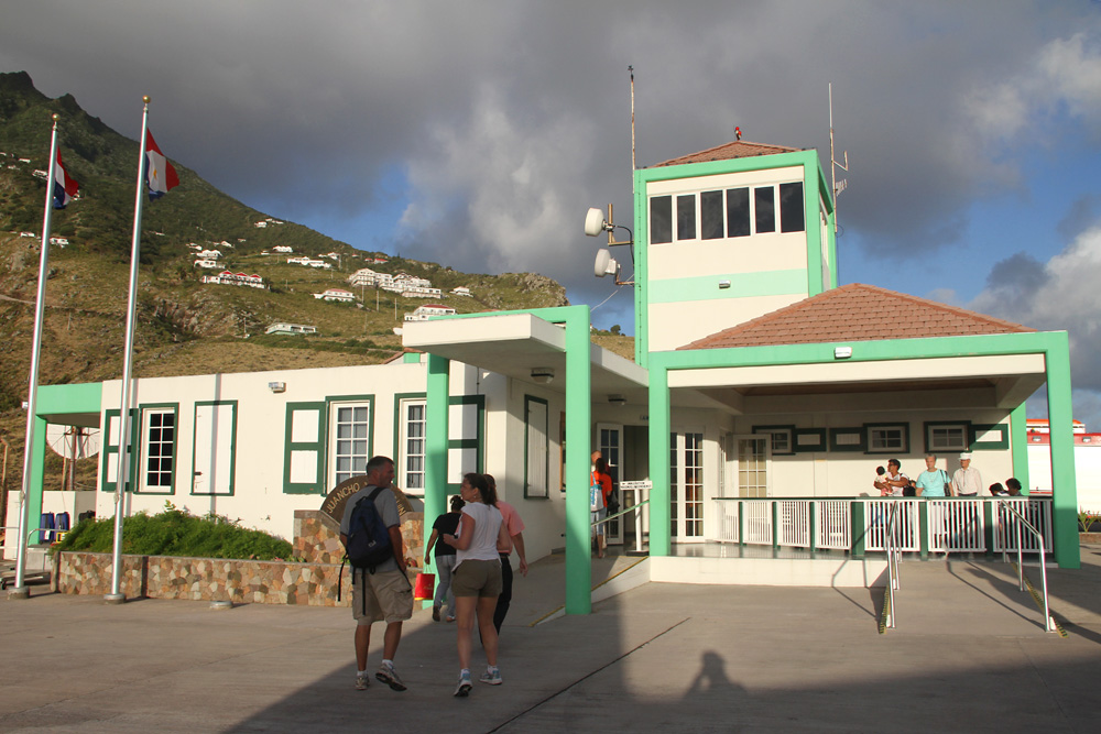
Gladly, I made it unbitten to the airport, whose full name is almost longer than its runway: Juancho Enrique Yrausquin Airport.

Terminal shot: Check-in area in the back, immigration counter to the left, and the baggage scan to the right. Several newspaper clippings and photos on the walls tell the history of aviation in Saba

No problem to pass the time till the arrival of my plane. This one touched down very late, and with a loud roar of the reverse thrust came to stand just a few feet from the sheer drop at the runway end. But well, they made it...!
Taxiing in to its stand - and despite her dream job, the female American co-pilot didn't smile a single time. Well, maybe she'd messed up that landing, too *gg*
By the way, this Twin Otter was built in 1975, and has been fighting wind, weather and short runways for 35 years now. Impressive!

Once again just seven minutes after the above shot, we've already completed our backtrack and are ready to rumble

With the pilots standing on the breaks, the engines were spooled up to full takeoff thrust, tearing at the fuselage, and finally their power was released and we shot along the short runway, the cliff at the end fast approaching. But we made it - from zero to airborne in 15 seconds - not bad!
Backlit, but still nice, I could catch a last glimpse of my beloved Saba - just Mount Scenery was already hiding in the clouds again...

Good load factor!
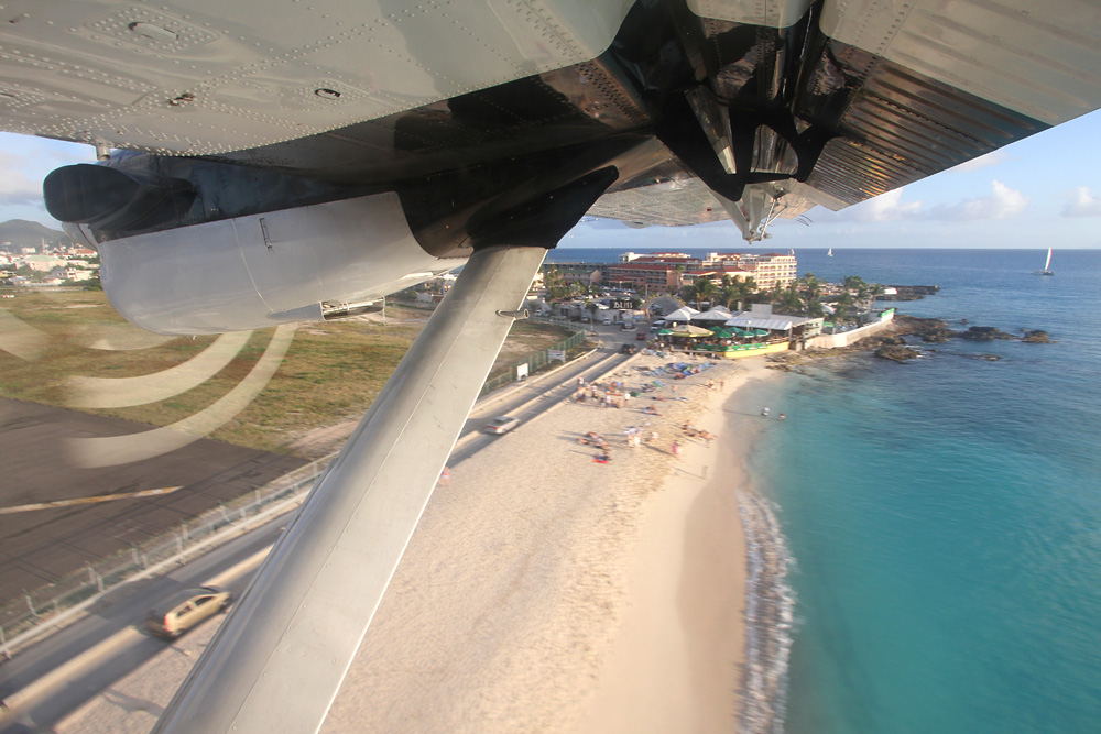
Finally, we're back in SXM, and high above famous Maho Beach, this adventure comes to an end...
My view on Saba? I abolutely loved it! It's so different to all the other Caribbean islands that I'd visited that the visit is extremely rewarding. No chi chi like on St. Barths, no cruise ship crowds like on St. Maarten - just down to earth villagers, stunning scenery and a relaxed way of life. If you have enough time, spending a night on two on this special island paradise is surely recommended!